Lot 679
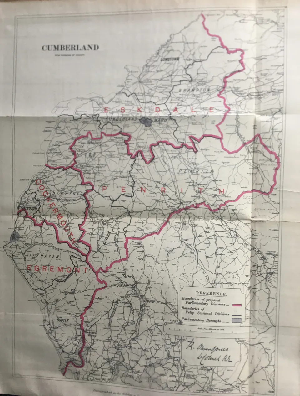
Antique 139 Years-Old Scarce Map Lake District Cumbria 1885 Boundary Changes.
Collectables
This lot has ended
20 Feb 2025 · No Reserve | British Boundary Maps 1868 | Audubon Birds of America | Antique Railway Station Routes | Job lots of Irish Maps 1777 | Memorabilia | Plus lots more
Description
Zincographed Ordnance Survey Map Produced by Colonel R. Owen Jones, Royal Engineers.
Report of the Boundary Commissioners Printed by Eyre and Spottiswoode 1885.
Measures Approx 20.5” x 15.5” (Inches) 52.07 x 39.37 (cm) Please Note That This Is a Folding Map.
This Map Was Prepared in 1885 For the Boundary Commission Report to Show The Current And Any Proposed Changes To The Parliamentary Divisions and Boroughs.
Virtually all Antiquarian Maps & Prints are Subject to Some.
Age-Related Wear, Marks, Discolouration, Spotting, Creasing Tears Little Rips Etc.
Please Study the Image to Establish Contents & Condition Prior to Bidding.
This Antique Print Would Look Great Framed & Mounted.
More from this auction

Dover & District Boundary Commission 157-Year-Old Large Antique Map.

Devonshire Boundary Commission 157-Year-Old Large Coloured Antique Map.

Wareham Dorset Boundary Commission 157-Year-Old Large Antique Map.

Somersetshire Boundary Commission 157-Year-Old Large Antique Map.

County Essex Boundary Commission 157-Year-Old Large Antique Map.

County Norfolk Boundary Commission 157-Year-Old Large Antique Map.

North Lancashire Boundary Commission 157-Year-Old Large Antique Map.

Ashton Under Lyne Manchester Boundary Commission 157-Year-Old Large Antique Map.
Get Collectables auction alerts
Be first to know when new collectables lots come up at William George. No spam — unsubscribe anytime.